

Commercial Real Estate
Industrial Real Estate Drone Photography: A Leasing Shot List
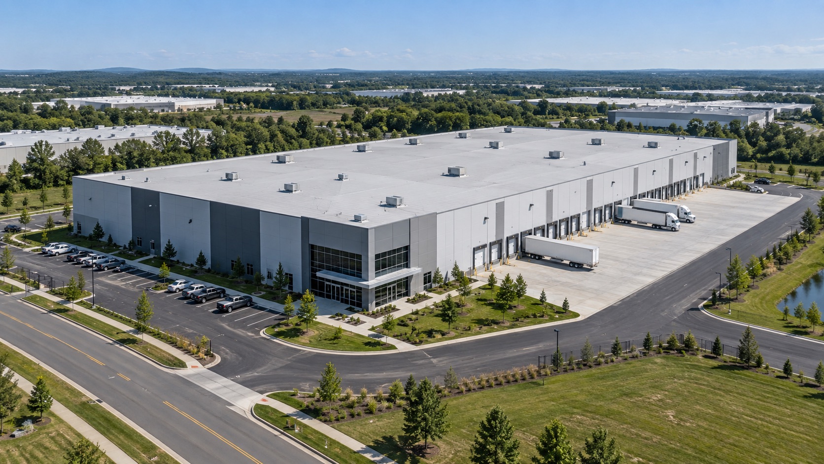
A warehouse can look impressive from the air and still leave a prospective tenant with basic questions. Where do trucks enter? Which side serves employees? How does the loading area relate to the road? What belongs to the available space?
Industrial real estate drone photography earns its place in a leasing campaign when the images make those relationships understandable. The objective is a visual sequence that helps an occupier decide what to investigate next.
That distinction matters in a cost-conscious market. CBRE’s 2026 U.S. Industrial & Logistics Occupier Survey identifies occupancy costs, lease flexibility, clear heights, and transportation access among building-selection priorities. Aerial imagery can explain the exterior setting; verified property documents must establish specifications and terms.
For brokers and marketing teams, the most useful brief starts with tenant questions. The following six views turn those questions into a practical industrial leasing shot list.
1. Establish the building and its operating context
Begin with an oblique overview that shows the whole building, its immediate grounds, and enough surrounding area to orient a first-time viewer. Favor a perspective where the main entrance and loading side are legible, when the site permits it.
The photograph should introduce the property before asking the viewer to interpret details. A tightly cropped roof might look graphic, but it cannot explain how the facility sits within an industrial park or along a public road.
Provide a second overview from the opposite direction when one angle hides a critical feature. For a partially available building, supply an approved plan identifying the marketed premises. Do not let a photograph imply that every visible bay, yard, or parking area is included in the lease.
2. Follow the truck approach to the gate
Ask for an approach view connecting the visible access road, entrance, and truck court. The audience should be able to trace the intended arrival path without guessing which driveway serves the property.
If passenger vehicles use another entrance, capture that relationship separately. A multitenant campus may need two complementary views to distinguish common access from a tenant’s operating area.
This is where careful captions help: identify the entrance and street only after the property team verifies them. Avoid claiming unrestricted truck access, specific turning capability, or an approved route based on appearance. Those conclusions require separate confirmation.
The same principle applies to highway proximity. A nearby interchange can provide context, but a straight-line view does not establish driving distance or travel time.
3. Show the truck court as a working space
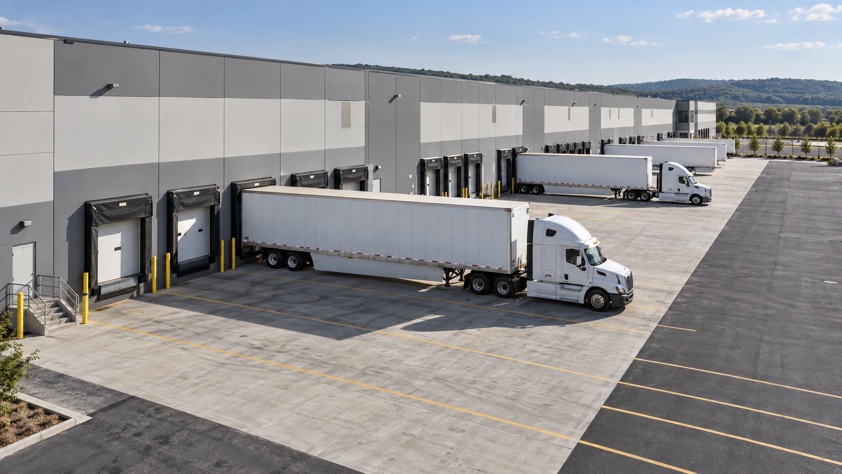
A useful loading-area photograph includes the dock face and the space in front of it. Showing only doors loses the relationship between the building, trailer positions, circulation, and adjoining activity.
Request an oblique view looking along the dock line, plus a broader view that shows the court’s visible edges. Where appropriate, a near-vertical image can make the arrangement easier to understand. The pilot should determine feasible positions around site activity and flight constraints.
Send confirmed court dimensions and dock information with the brief if they will appear in the marketing materials. Perspective can distort apparent depth, and parked trailers may conceal details. Aerial photographs communicate layout; they should not become an improvised measurement method.
For an occupied facility, coordinate a suitable window with the site contact without staging activity that misrepresents normal conditions.
4. Make employee and visitor arrival legible
Industrial leasing also involves people arriving for work, meetings, maintenance, and deliveries in smaller vehicles. Include a view of the office entrance, visible parking arrangement, and connection to the site’s circulation.
This image often belongs immediately after the loading sequence. It gives the reader a different scale: the address they approach, the entrance they use, and the relationship between office and warehouse functions.
Do not infer available parking capacity from an empty lot or promise exclusive spaces unless the property team confirms them. If parking is shared, say so in the supporting materials. Where trees, canopies, or building geometry obscure an entrance, supplement the aerial with separately scoped ground photography instead of forcing an unhelpful drone angle.
5. Explain yard space without overstating its use
Outdoor areas deserve deliberate coverage when they are relevant to the assignment. Show their position relative to the building, visible access points, fencing, and neighboring uses. A wide context image and a closer oblique view can serve different purposes.
The leasing team must verify what the tenant may actually use. An open area might be shared, reserved, outside the lease, or subject to restrictions. An image alone cannot establish permitted storage, expansion rights, drainage performance, or development capacity.
Avoid speculative parcel outlines. If a graphic is necessary, work from an owner-approved reference and label any illustrative boundary appropriately. Keep the original photograph available alongside the annotated version so the marketing team can revise the presentation when the scope changes.
6. Connect the property to the wider logistics story
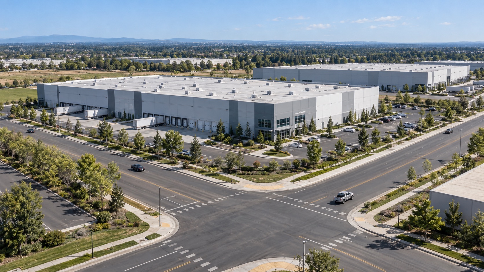
Finish the sequence with regional context that is visible and relevant: the industrial cluster, adjoining roads, or a nearby transport corridor. The aim is to place the building within its surroundings without making unsupported operational claims.
CBRE’s industrial site-selection approach considers supply chain, labor, incentives, and real estate together. Drone imagery supplies one visual layer within that larger evaluation. It cannot establish labor availability, transportation costs, or utility capacity.
For a listing package, pair the aerial with a verified location map and factual property specifications. Let each format do its job. The photograph builds spatial understanding; the map explains connections; the documents substantiate the claims.
A brief your team can reuse
Before requesting a shoot, collect the property address, available premises, approved site plan, intended audience, launch deadline, and site contact. Add the questions the images must answer, the features to prioritize, and any areas to exclude for privacy or operations.
Then specify the deliverables: still photographs, original video clips, a finished edit, or a combination. Tell the provider where the assets will appear so framing can accommodate a brochure, listing page, or presentation. Establish how annotations, filenames, and revisions will be handled.
For a portfolio, keep these instructions consistent while adapting the six views to each property. A small flex building and a distribution campus should answer comparable questions without receiving identical shot assignments.
Finally, review the proposed sequence as a tenant would: orientation, arrival, operations, people, outdoor space, and location. If a crucial question remains unanswered, revise the brief before the flight.
Give every selected image a role in the finished campaign. Use the overview to introduce the listing, the access view to support a broker conversation, and the loading sequence to prepare an operations team for its tour. Keeping that purpose visible makes it easier to choose between similar frames and prevents a beautiful but repetitive gallery from burying the information readers need.
Put the leasing objective in the flight brief
Up Sonder coordinates nationwide aerial projects, including pilot selection, scheduling, airspace review, and flight planning. Its commercial aerial packages cover photography, original 4K clips, and finished video options, with scope and timing confirmed before booking.
Bring the address, deadline, and the tenant questions that matter most. Share your project with Up Sonder to plan imagery that helps your team present the property clearly and move the leasing conversation forward.