

Commercial real estate
Nationwide Commercial Real Estate Drone Photography: A Scalable Program for CRE Firms
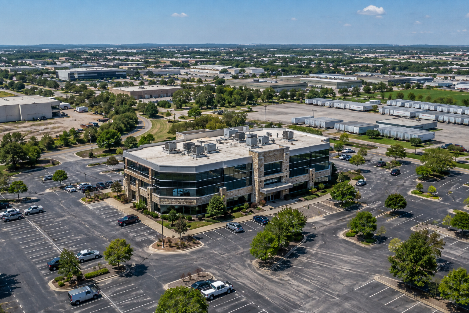
Commercial real estate firms rarely operate one property in one market. Brokerages represent listings across several states, developers manage projects in multiple regions, and investment firms oversee geographically dispersed portfolios. Yet drone footage is still often ordered one assignment at a time, with a local office searching for “someone with a drone” whenever a need appears.
That approach may work for an isolated property, but it becomes inefficient at scale. Each vendor can introduce a different price, shot style, turnaround time, file format, communication process, and interpretation of the assignment. The firm may receive usable aerial property photography, but only after employees spend time sourcing pilots, explaining expectations, monitoring schedules, reviewing files, and arranging corrections.
A scalable commercial real estate drone photography program creates a repeatable system through which a firm can order, coordinate, and receive consistent aerial capture wherever its properties are located. For CRE organizations that care about transaction speed, internal efficiency, brand standards, and portfolio consistency, that operating model matters as much as the final footage.
A Drone Program Is Different From Hiring a Pilot
Hiring an individual pilot is a transaction. The CRE team explains the property, negotiates the scope, confirms availability, provides instructions, and hopes the final work matches expectations. When another assignment appears in a different city, the process begins again.
A centralized drone program turns those transactions into infrastructure. The firm establishes a standard scope once, including required photography, video movements, property framing, delivery specifications, and communication procedures. That standard can then be applied across shopping centers, offices, industrial facilities, medical buildings, development land, and multi-asset portfolios.
National and regional CRE professionals should be focused on winning assignments, underwriting opportunities, communicating with investors, and advancing transactions—not supervising a fragmented network of local media vendors. The right partner functions as an outsourced aerial capture department, providing local execution through one centrally managed relationship.
Consistency Makes Drone Footage More Useful
Inconsistent imagery is often treated as a cosmetic problem, but its consequences extend further. One property may be shown from all four directions, while another has only two high-altitude photographs. One video may explain road access and tenant visibility, while another spends most of its time circling the roof. Even when each pilot produces attractive work, a portfolio can feel fragmented because the assets were not captured according to the same visual logic.
Standardization creates comparability. A structured commercial protocol can require the entire subject property to remain in frame, eye-level perspectives that establish curb appeal, low-altitude passes that show façades and operating areas, medium-altitude orbits that explain the site plan, and higher approaches that establish market context. Directional coverage can show how customers, employees, and delivery traffic see and access the property.
This consistency also prevents missing information. Marketing teams can build offering memorandums without discovering that a critical angle was never captured, while investment teams can evaluate assets through a common visual framework.
Compliance and Flight Planning Cannot Be Improvised
Commercial drone capture is also an aviation operation. The Federal Aviation Administration requires pilots operating under Part 107 to hold a Remote Pilot Certificate, and flights in controlled airspace may require FAA authorization through LAANC or a manual process before takeoff. Federal Aviation Administration
A CRE firm should not have to become an airspace expert, but it does need confidence that every assignment is handled by someone who understands the rules. A property near an airport may have an altitude restriction that changes the available shots. Temporary flight restrictions, nearby aircraft, obstacles, people, vehicles, and site conditions can also affect the operation.
Professional planning identifies these constraints before the pilot arrives. Weather must also be monitored because wind, poor visibility, and unfavorable lighting can make a legal flight unsafe or produce weak material. A managed provider knows when to proceed, adjust the plan, or reschedule to protect both the client and the deliverable.
The Capture Strategy Must Match the Asset
Standardization does not mean every property should be filmed identically. A successful program combines consistent baseline coverage with an asset-specific strategy.
For retail, footage should explain storefront visibility, signage, anchor relationships, parking circulation, curb cuts, and traffic exposure. Industrial properties require attention to truck courts, loading docks, yard configuration, highway access, and logistics routes. Office footage should establish campus layout, parking, employee access, and nearby amenities. For development land, priorities may shift toward access, terrain, surrounding growth, infrastructure, and the parcel’s relationship to existing development.
A pilot focused only on attractive footage may not understand which characteristics matter most. A CRE-focused protocol directs attention toward how the asset functions and how an investor, tenant, lender, or developer is likely to evaluate it. That is the difference between generic aerial video and purposeful commercial property intelligence.
Centralization Reduces Hidden Internal Work
The cost of a decentralized vendor model is not limited to the pilot’s invoice. Someone inside the CRE firm must locate and vet the vendor, request a quote, communicate the assignment, coordinate with the property contact, monitor weather, confirm completion, download files, review clips, request missing coverage, and process payment.
Repeated across dozens of properties, those tasks become a substantial operational burden. Centralized nationwide drone services give the firm one process and one point of coordination. The provider handles pilot deployment and local logistics while the CRE team communicates the business objective and receives standardized deliverables. This is particularly valuable when multiple assets must launch on a shared schedule.
The Work Continues After the Drone Lands
The flight is only one phase of professional capture. Commercial footage must still be uploaded, downloaded, organized, reviewed, edited, exported, and delivered in useful formats. Each clip must be checked for stability, exposure, focus, composition, and completeness.
Quality control determines whether footage is merely attractive or actually useful. A missing rear-access view may not be discovered until an offering memorandum is nearly finished. By then, arranging a return visit can delay the launch and increase cost. A managed program reviews the work against the assignment before treating the mission as complete.
A well-planned mission can also support more than one use. The same collection may contribute to an offering memorandum, broker opinion of value, leasing presentation, investor campaign, property website, lender discussion, or future disposition strategy. Complete capture creates a reusable visual library rather than a one-time set of pictures.
Up Sonder Gives CRE Firms an On-Demand Drone Program
Up Sonder is designed around this centralized model. It provides commercial real estate drone services across all 50 states through a network of certified pilots in more than 1,000 cities, allowing CRE clients to coordinate geographically dispersed assignments through one provider. Up Sonder
The value is not limited to access to a pilot. It is the combination of nationwide reach, standardized capture, centralized project management, FAA-aware planning, quality review, and organized delivery. Brokerages, developers, owners, and investment firms gain the practical benefits of an internal drone program without recruiting pilots, managing flight operations, or creating another department.
As CRE firms grow, their visual-content operations must become as scalable as their transaction pipelines. A patchwork of local vendors may produce acceptable results one property at a time, but it places coordination, quality, and compliance responsibilities back on the client. A centralized commercial real estate drone photography program replaces that fragmentation with a repeatable process that can support one listing, a regional portfolio, or a nationwide campaign.
Strong CRE firms do not merely purchase photographs; they build systems that help their professionals move faster, present assets consistently, and reduce avoidable work. Drone capture should be treated the same way. Visit Up Sonder’s website to establish a scalable aerial capture program for your firm’s listings, developments, and portfolio, with one nationwide partner managing the process from booking through final delivery.