In commercial real estate, drone photography is no longer a novelty. It’s expected. But while most brokers now understand the value of aerial visuals, far fewer understand what professional-grade commercial drone capture actually requires.
Not all drone footage is created equal.
A random aerial pass over a property might look impressive—but institutional investors don’t evaluate properties based on “impressive.” They evaluate them based on clarity, completeness, and operational understanding. And that only happens when drone capture follows a structured, strategic shot list.
At Up Sonder, we don’t just fly drones. We execute standardized commercial capture protocols designed specifically for retail, office, industrial, and multi-market portfolios. This article breaks down what every serious commercial drone shoot should include—and why missing even a few of these elements creates friction for investors.
Why Structure Matters in Commercial Drone Capture
Commercial assets are operational systems. They rely on access, visibility, circulation, adjacency, and scale. Drone capture must communicate all of those clearly.
When brokers rely on unstructured or inconsistent drone work, three things happen:
- Investors ask more questions.
- OMs require more explanation.
- Deals move slower.
A structured shot list eliminates guesswork and ensures that every critical angle is captured the first time.
Up Sonder’s standard commercial shot protocol is built around four altitude layers. Each one answers different investor questions.
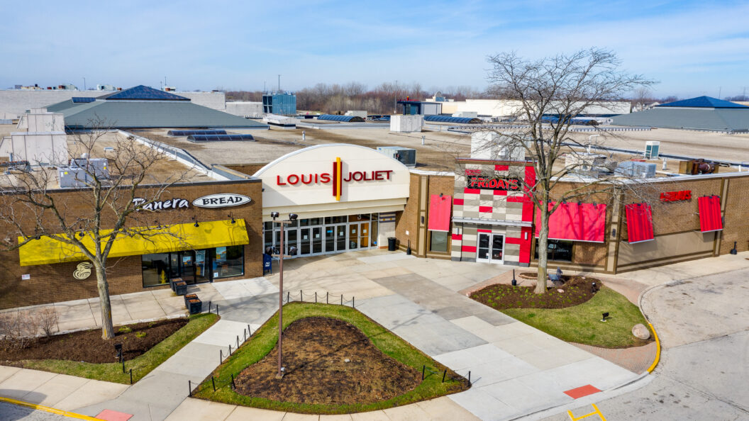
1️⃣ Ground-Level (Eye-Level) Context Shots
Even though this is “drone capture,” the first layer starts at eye level.
Why?
Because investors still want to see the property the way a tenant or customer sees it. Ground-level drone shots provide stabilized, high-resolution visuals that show:
- Primary façade
- Signage clarity
- Parking orientation
- Street visibility
- Across-the-street context
Photos should include front, sides, and corner perspectives that best represent the asset’s presentation and curb appeal.
For retail, this shows branding exposure.
For office, this communicates professional positioning.
For industrial, this demonstrates access and frontage.
Skipping ground-level capture removes orientation. Investors begin their evaluation process without a mental anchor.
2️⃣ Low-Altitude (Roof-Level) Operational Views
The second layer moves just above roof height—but intentionally avoids showing the top of the roof at this stage.
Why? Because this elevation focuses on functionality rather than condition.
This level should include:
- Full perimeter coverage (N, E, S, W, and diagonals)
- Front, back, and sides
- Corner angles that frame the structure in context
More importantly, it includes structured video sequences:
- Lateral “dolly” shots across the front
- Lateral dolly shots across left, right, and rear
- Straight-on approach and reverse pull-away shots
These are not artistic movements. They are operational documentation.
Dolly shots show:
- Depth of parking
- Curb cuts
- Tenant bays
- Loading zones
- Traffic adjacency
For retail centers, these reveal traffic pull and storefront rhythm.
For office parks, they demonstrate scale and layout.
For industrial assets, they show truck movement potential.
Without this layer, investors cannot fully understand how the property functions day-to-day.
3️⃣ Medium-Altitude Strategic Framing
This layer is where investor comprehension accelerates.
Medium-altitude capture frames the property alongside its immediate surroundings. It answers:
- How does this property sit within the corridor?
- What neighbors matter?
- How dense is surrounding development?
- What traffic arteries define access?
At this level, we include:
- Multi-directional photo coverage
- A slow 360-degree orbit (entire property in frame)
- Straight-down flyover
- Frontage road passes (both directions)
- Pull-back-and-rise sequence from full-frame building view
This is where investor friction drops dramatically.
The 360-degree orbit ensures the entire subject property remains visible at all times.
The flyover looking straight down clarifies parcel layout.
Frontage road passes reveal signage exposure and real-world traffic interaction.
The pull-back-and-rise sequence transitions the investor from “asset” to “market.”
For industrial:
This layer reveals truck routes, rail adjacency, and yard depth.
For retail:
It shows outparcel positioning and anchor relationships.
For office:
It communicates corporate park scale and surrounding business ecosystem.
Missing this layer forces investors to piece together geography manually—and that’s where hesitation begins.
4️⃣ High-Altitude Market Context
The final layer is strategic overview.
High-altitude shots must frame:
- Entire subject property
- Surrounding development
- Road systems
- Competing uses
- Residential density
Approach shots from all four cardinal directions are critical:
- North-to-south approach
- West-to-east approach
- East-to-west approach
- South-to-north approach
Why?
Because investors mentally simulate how customers, employees, and logistics move through a site. Seeing it from all directions removes uncertainty.
This level communicates:
- Regional access strength
- Market dominance positioning
- Traffic corridors
- Competitive adjacency
It’s not about flying as high as possible. It’s about flying high enough to show relevance.
When high-altitude coverage is missing, OMs rely on Google Earth screenshots—and that immediately lowers the perceived professionalism of the package.
Why Missing Shots Create Investor Friction
Commercial investors rarely say, “This OM is missing shots.”
Instead, they ask:
- “Can you send something showing the rear access?”
- “What does the property look like from the other direction?”
- “Is there rail behind it?”
- “How close is that competing center?”
- “What’s across the street?”
Each question introduces delay.
Structured drone capture answers these questions before they are asked.
And in competitive processes, the broker who removes friction wins attention first.
Retail vs Office vs Industrial: Shot Emphasis Differences
While the four capture layers remain consistent, emphasis shifts by asset class.
Retail:
- Heavy focus on frontage road passes
- Signage visibility
- Anchor tenant context
- Ingress/egress clarity
Office:
- Campus scale
- Landscaping and environment
- Access to business corridors
- Parking ratio visualization
Industrial:
- Truck routes
- Dock positioning
- Yard depth
- Rail or highway proximity
The key is intentionality. A structured shot list adapts emphasis but never sacrifices completeness.
Why Standardized Capture Matters in Multi-Market Portfolios
For brokers marketing 5, 15, or 50 properties across different cities, inconsistency kills credibility.
If one property has full directional approaches and another only has two random aerial shots, investors notice.
Standardized capture ensures:
- Every asset is evaluated fairly
- Every OM feels cohesive
- Institutional buyers can compare apples to apples
This is where scale matters.
Up Sonder’s national network allows brokers to deploy the same structured shot list in any U.S. market. No patchwork vendors. No uneven quality.
Consistency builds institutional trust.
Commercial investors don’t just evaluate properties. They evaluate brokers.
A structured drone protocol signals:
- Preparation
- Operational understanding
- Investor alignment
- Attention to detail
Unstructured drone work signals improvisation.
In today’s CRE environment, preparation wins.
Up Sonder’s Structured Approach
At Up Sonder, every commercial drone shoot follows a documented protocol:
- Entire subject property must remain in frame
- Multi-directional coverage
- Layered altitude strategy
- Cardinal approach sequences
- Structured dolly movements
- Friction-reduction framing
This is not artistic improvisation. It’s operational clarity.
Our pilots don’t “grab a few shots.” They execute a capture plan built for commercial underwriting.
And because we operate in over 1,000 U.S. cities, brokers can rely on the same structured output whether the asset is in Los Angeles, Houston, Phoenix, Chicago, Charlotte or Tampa.
Drone footage is no longer about aesthetics.
It is about reducing uncertainty.
It is about eliminating friction.
It is about answering investor questions before they are asked.
A strategic shot list transforms drone capture from marketing decoration into underwriting infrastructure.
If you want your listings to move faster, attract stronger investors, and present with institutional clarity, the process matters.
Up Sonder delivers that process—nationwide, consistently, and professionally.
Visit UpSonder.com to schedule structured commercial drone coverage for your next listing and elevate your presentation from attractive to strategic.